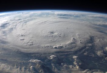
The Japan Meteorological Agency has confirmed that two significant tropical cyclones are on convergent trajectories toward the Japanese archipelago. Typhoon Mekkhala, classified as a Category 3 system, and Tropical Storm Higos are both propagating northward across favorable oceanic conditions. Current meteorological models indicate that both systems will reach the vicinity of the main islands within 72 hours. The critical uncertainty stems from the proximity of their projected paths, which may result in direct atmospheric interaction between the two cyclonic disturbances.
When tropical cyclones come within a critical distance threshold of one another, they become subject to the Fujiwhara effect, a dynamical phenomenon wherein mutual gravitational attraction and baroclinic influences produce complex behavioral modifications. The storms may exhibit divergent movement patterns, whereby they deflect away from each other on altered courses. They might alternatively traverse the region in sequential formation, with one system effectively steering the other's trajectory. The most operationally significant possibility involves merger, whereby the vortices combine into a single, potentially intensified cyclonic system with substantially enhanced destructive capacity.
This forecasting ambiguity represents a considerable challenge for emergency management infrastructure. Conventional numerical weather prediction models operate under assumptions of isolated, independent storm systems and lack adequate parameterization for interacting cyclones. Consequently, predictive confidence intervals have widened substantially, forcing authorities to develop contingency frameworks accommodating multiple concurrent scenarios. Resource allocation decisions regarding evacuation logistics, emergency shelter positioning, and emergency services deployment must now account for a spectrum of potential impact configurations spanning geographical regions that may or may not be affected depending on the storms' ultimate interaction dynamics.